Ranch Introduction
Join us on a brief 4 1/2 minute tour of the ranch and it's history.
All Types of Productions
This 1 minute video shows the variety of productions that have filmed on B.R.
Additional Photos
This 2-minute slide show presents additional photos of Blayney Ranch.
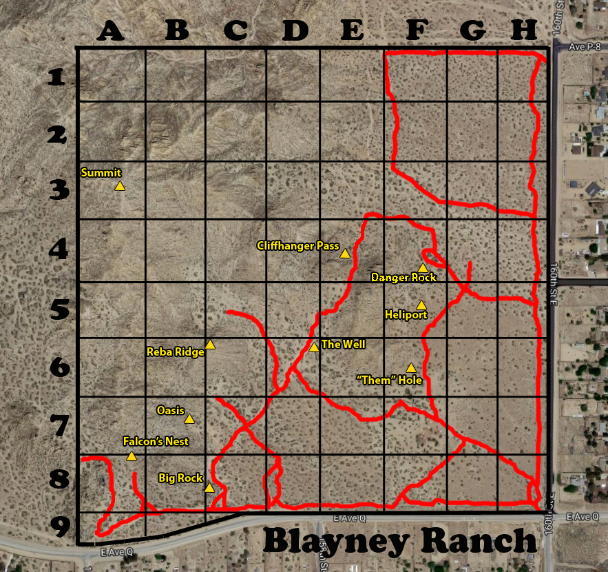
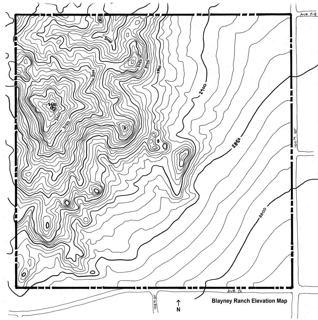
Grid & Elevation Maps
Use the coordinates on the grid map to locate the specific places on Blayney Ranch that you are interested in filming at. The red lines show our primary roads. we have three points of access. Our west entrance is located in grid D8. Our south entrance is in grid H8 and our north entrance is in grid H1.
The Elevation map will give you an idea of how sloped the ground is on Blayney Ranch. The south/east corner is our lowest spot at about 2775' and the "Summit", our highest peak, is 3251'. The ranch is 1/2 mile square.


